
It’s easy to look at a map of the British Isles and assume that the outline of land that’s so familiar to us has been that way for millennia. However, the coastline – particularly in the east – has changed dramatically over the centuries, partly due to human intervention (such as the draining of marshy areas) and partly due to the forces of nature. Often, these changes are quite gradual and happen over many years (for example, towns on the Norfolk coast that have been gradually disappearing into the sea over many decades and centuries), but sometimes, a storm or other natural disaster could change the fortunes of coastal towns overnight. New Romney in Kent is one of these places. Once a thriving and important port, a terrible storm in 1287 cut off the town’s lifeline.
New Romney was one of the Cinque Ports, five ports in the south east of England that received tax relief and other benefits on the condition that they maintained a fleet of boats for the use of the monarch. These ports were strategically important – they were close to Normandy, where the Norman Kings of England and many of their barons had lands. Before the Norman Conquest, Edward the Confessor had recognised their importance and the Confederation of the Cinque Ports dated from his reign (1042-1066).
The other four ports that made up the Cinque Ports were Hastings, Hythe, Dover and Sandwich, and the “antient towns” of Rye and Winchelsea were also recognised as being affiliated with the Cinque Ports.

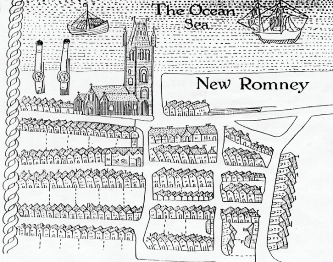
New Romney was located at the mouth of the River Rother, and before disaster came to the town in 1287 it was a prosperous place. Although by the 13th Century the harbour was beginning to silt up, a canal called the Rhee Channel was constructed between the River Limen and New Romney to improve the flow of water and prevent further silting up from occuring. The fact that a canal was constructed to help keep New Romney’s harbour operating shows how valued it was by local people. A 1799 history of New Romney describes the town at its height: “a large and commodious harbour for shipping, and the town adjoining to it increasing to a considerable size, and being well filled with inhabitants.”
However, in February 1287 disaster struck New Romney, with far-reaching consequences for the town. A ferocious storm hit the south coast of England, depositing huge quantities of sand, mud and shingle inland and causing the coastline to change dramatically.
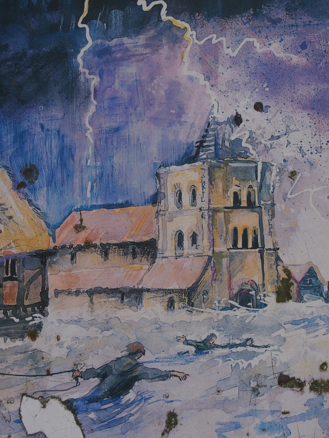
The most dramatic impact of the storm was the River Rother changing its course as a result of the mud and shingle that was deposited on and around New Romney. Such huge quantities of mud, sand and shingle were deposited on New Romney that the harbour and the mouth of the river were completely blocked. The river’s waters created a new channel that flowed out to sea at Rye, about fifteen miles away. The river still follows this altered course today. The Rhee Channel was also blocked by deposits of sand and shingle and eventually it dried up.
History doesn’t record the effect the storm of 1287 had on individuals living in and around New Romney, but the cost must have been high. It’s likely that many of New Romney’s inhabitants lost their lives during the storm. People who depended on the river or the sea for an income lost their livelihoods, and the tonnes of sand and gravel swept into the town by the high winds probably destroyed many homes, boats, businesses, farms and workshops too. So much material was deposited by the storm and resulting floods that the ground level in New Romney was permanently raised.
Attempts were made to clear the debris from the harbour, but following the storm the port went into terminal decline. The coastline moved to the south, and by the 16th Century New Romney was over a mile from the coast. The local economy became more dominated by agriculture – large parts of Romney Marsh were drained and used as farmland in the medieval period, and the marsh is the place of origin of the hardy Romney sheep, which is now found all over the world.
Other ports in the south east fared badly as well. Winchelsea was completely destroyed, and was later rebuilt on a new site on higher ground (the site of old Winchelsea is now some way out to sea). Hastings lost a section of its castle when the cliff below it collapsed – this also destroyed many of the town’s port facilities. And the terrible storm of February 1287 was not the last catastrophe to hit the British Isles in that year – in December, a storm surge that also devastated parts of the Low Countries caused widespread flooding in East Anglia and killed hundreds of people.
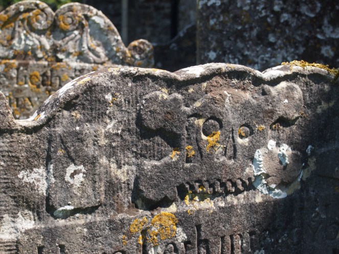
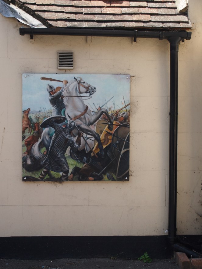
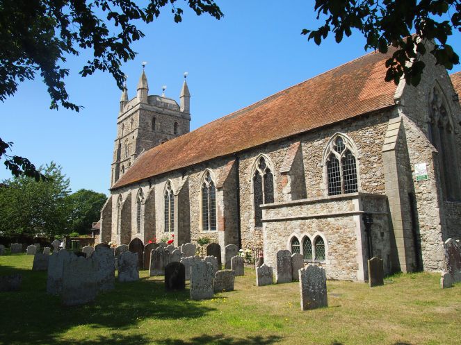
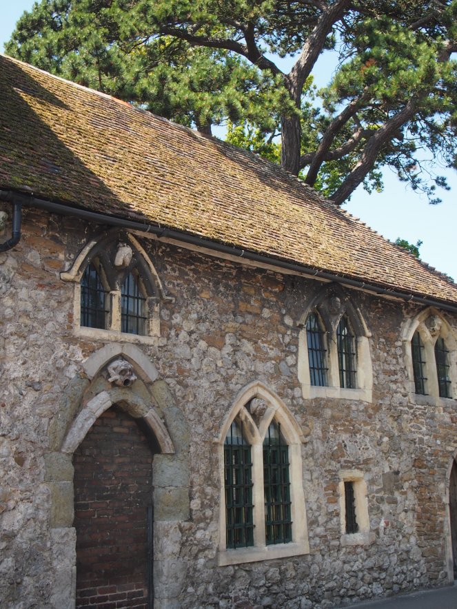
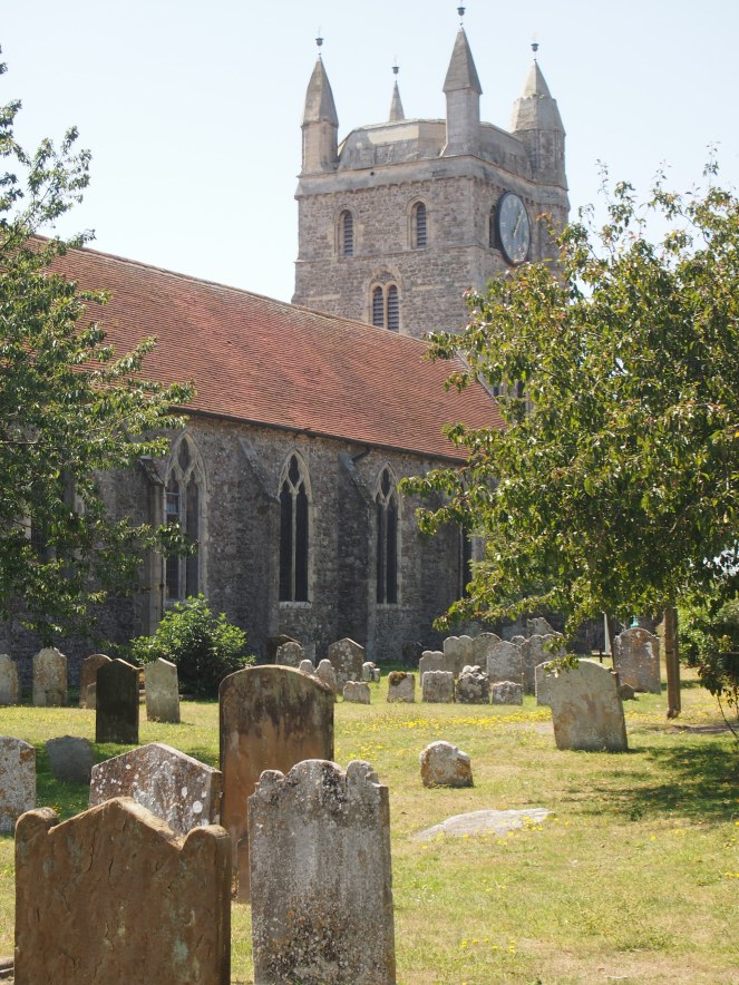
Like many towns in the Romney Marsh area, New Romney is dominated by a large Norman-era church, which is dedicated to St Nicholas. New Romney’s links to the Norman era are commemorated by an art installation close to the church, which includes panels describing the town’s history. New Romney is only about twenty-five miles from Hastings, and the town was sacked by William the Conqueror’s forces not long after the Battle of Hastings in 1066 – it is thought that this was in retaliation for New Romney’s residents preventing William’s forces from landing close to the town before they eventually landed further west in Sussex. Despite this attack, by 1086 – when the Domesday Book was collated – New Romney was still a significant town with a harbour, a church and even a mint for the striking of coins.
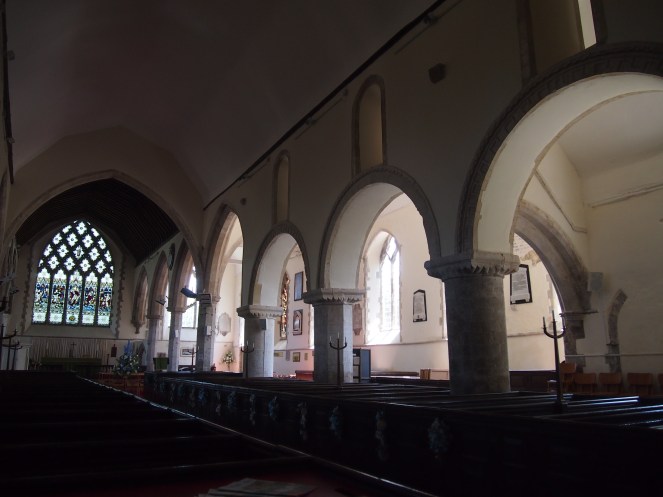
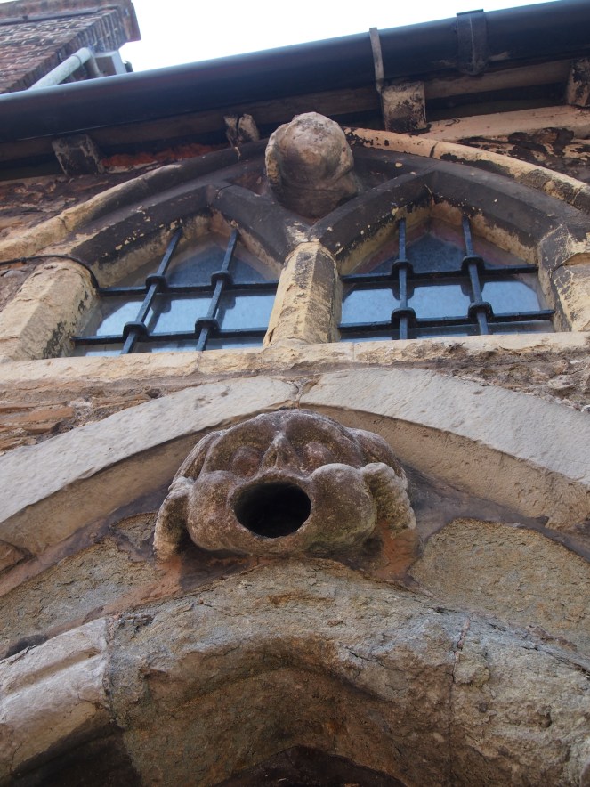
The nave and the tower at St Nicholas – fittingly for a harboursite church, dedicated to the patron saint of mariners – date from the 12th Century, with the tower in particular featuring many of the characteristic rounded Norman arches over windows and doorways.
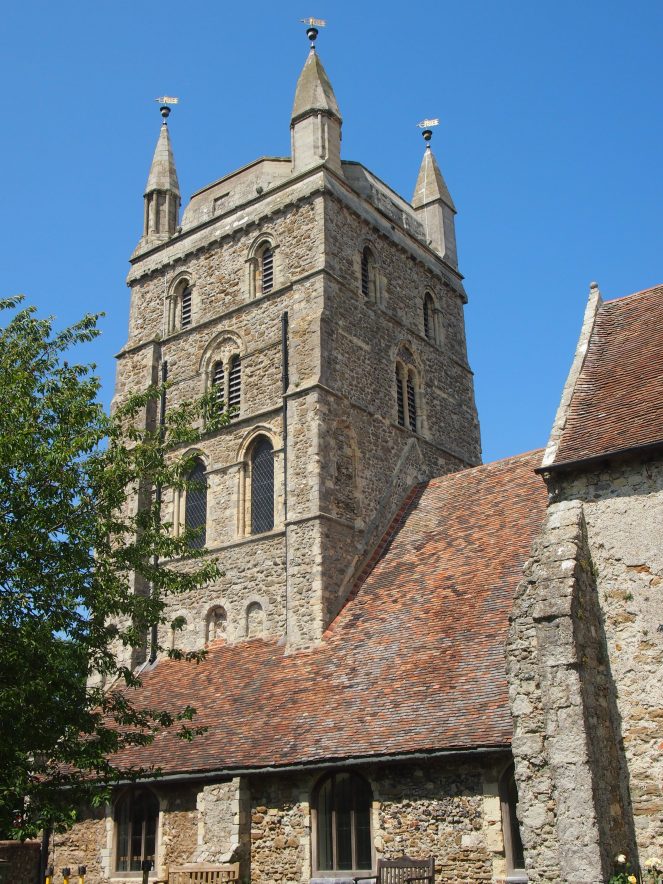
This magnificent building witnessed the terrible destruction wrought on the town in 1287. It’s hard to imagine it now, but in the before the storm the church was on the harbourside – close enough to the sea to have boat hooks fixed into its walls. It’s not clear exactly how badly damaged the church was in the storm, but the Gothic additions to the church date from the 13th and 14th Centuries, suggesting that they might have replaced a section of the church damaged or destroyed in the storm.

Like so many other medieval churches, St Nicholas was in need of repairs and restoration by the Victorian period and plans were put forward to restore the church. However, because these plans involved the demolition of some of the 12th Century sections of the building, there was a public outcry. The Society for the Protection of Ancient Buildings, which had been set up by William Morris and Philip Webb in 1877, weighed in on the argument and opposed any work done on the church that was unsympathetic to the building’s medieval fabric. The planned restoration work was halted and the 12th Century features of the church were saved.
Before the storm of 1287, the church of St Nicholas was not the only church serving the residents of New Romney. The town was populous enough to have three churches. But the decline of the town following the damage to its port facilities meant that the population fell, and New Romney’s other churches were surplus to requirements. A park can be found on the site of one of these churches, St Martin, which was demolished in the mid-16th Century. Excavations in St Martin’s Field in 2005 uncovered a number of burials in what would have been St Martin’s churchyard.

The church of St Nicholas is the only building that survives in New Romney from the pre-storm days, but there are a handful of other medieval buildings in the town. One of them, opposite St Martin’s Field, is thought to have been part of a priory that was once situated in New Romney. This priory was a cell of the French Cistercian abbey of Pontigny, which had links with the Archbishops of Canterbury due to Thomas Becket sheltering there whilst in exile. Possession of the priory passed to the Crown in 1414, due to England’s war with France, and it was was later granted to All Souls College, Oxford.
The destruction of the medieval port at New Romney has resulted in the town being of particular interest to archaeologists. A number of digs have taken place over the years, with archaeologists now often investigating sites that are being dug up by workmen to repair or replace pipes and other services. In the 1950s, a workman found some timber beams near St Nicholas’ church, suggesting the presence of a harbourside wharf, and in more recent years archaeologists have uncovered burials, artefacts and the remains of buildings in the town which have helped to paint a picture of New Romney’s past.
The fate of New Romney after the terrible storm of 1287 shows how particularly vulnerable coastal settlements are to the powers of the elements. New Romney’s decline as a port is far from a unique story. Some coastal towns and villages are cut off from the sea, while others disappear beneath the water. Earlier this week, the BBC published an article about how Cajun villages and towns in Louisiana are disappearing into the sea due to coastal erosion.
Today, New Romney is the largest town on Romney Marsh, and it’s home to the marsh’s only high school, as well as a charming narrow gauge railway that transports people between Hythe, New Romney and Dungeness. When I visited, I was struck by the many references to the town’s history as one of the Cinque Ports – although the town’s harbour is long gone, its importance in the development of New Romney has not been forgotten.

References and further reading
The Medieval Churches of Romney Marsh, Romney Marsh Historic Churches Trust, 2012
History of Romney Marsh, Romney Marsh, the fifth continent http://theromneymarsh.net/history
Edward Hasted, “The town and port of New Romney” in The History and Topographical Survey of the County of Kent: Volume 8, 1799 http://www.british-history.ac.uk/survey-kent/vol8/pp446-464
New Romney First Time Sewerage Scheme 2004-2006, Canterbury Archaeological Trust, March 2006 http://www.canterburytrust.co.uk/news/projectdiaries/newromney/
Kent Historic Towns Survey – New Romney – Archaeological Assessment Document, Kent County Council and English Heritage, December 2004 http://archaeologydataservice.ac.uk/archiveDS/archiveDownload?t=arch-459-1/dissemination/pdf/New_Romney.pdf (PDF)
William Page (ed), “Alien houses: the Priory of New Romney” in A History of the County of Kent: Volume 2, 1926 http://www.british-history.ac.uk/vch/kent/vol2/p239a

Fascinating! The history, indeed fate, of Dunwich is similar.
LikeLike
As always, Caroline, a beautifully written and fascinating journey into a bit of English history. I love your photos too. When we look at what remains from the past, it is a challenge to imagine what existed before. By the way, I appreciate your inclusion of the References for Further Reading. Very professional.
LikeLike
I endorse the earlier comments – always an enjoyable and instructive read.
LikeLike
Fabulous post. I really enjoy your blog.
LikeLike
Loved reading this. Thankyou for the research and photographs.
LikeLike